Angela
Elite member
- Messages
- 21,823
- Reaction score
- 12,329
- Points
- 113
- Ethnic group
- Italian
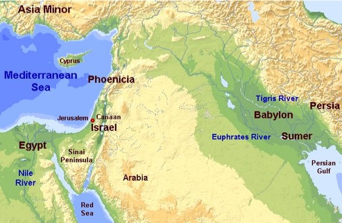
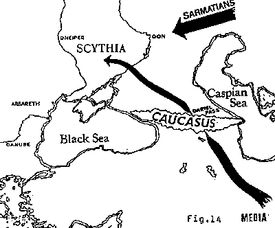
I see no reason why the Gravettians could not have crossed from Anatolia directly into the Balkans, as many scholars maintain. At the time period in question, there was no Hellespont between Anatolia and the Balkans. It was all land. Much easier than traversing the Caucasus mountains.

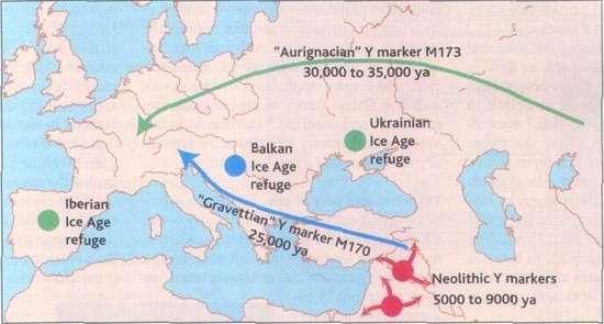
I think it was the Augignacians, probably carrying yDna "C" who went into Europe from north of the Caucasus.
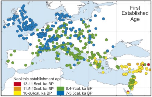
Neolithic people very much liked boats.
They were in Cyprus and Crete long before they were near the Hellespont:
If people are so interested in the precise difference between Stuttgart like people and their ancestors in the Near East, I would think a Neolithic genome either from the coastal Levant, Cyprus, or Crete might be a good idea.
This might be the way it moved...Druse like people (northern Levant), Cappadocia (southwestern Turkey), Dodecanese (Greek islands near Turkey), East Rumelia, Crete, Sicily and the Peleponnese, up the Balkans, by sea along the Mediterranean littorals, and on and on.
http://www.pnas.org/content/111/25/9211.full

I'm not saying that the Near Eastern farmers were identical to these modern people, but I think we can trace the route through them.
Given that E-V13 has shown up all the way in Armenia, and we have one that traveled with Cardial, I still think they're a good bet for one of the founding y lines.
@Garrick,
By the time of the Bronze Age Indo-Europeans, crossing the Hellespont from the Balkans into Anatolia would have been child's play.
I think it was the Augignacians, probably carrying yDna "C" who went into Europe from north of the Caucasus.
Neolithic people very much liked boats.
They were in Cyprus and Crete long before they were near the Hellespont:
If people are so interested in the precise difference between Stuttgart like people and their ancestors in the Near East, I would think a Neolithic genome either from the coastal Levant, Cyprus, or Crete might be a good idea.
This might be the way it moved...Druse like people (northern Levant), Cappadocia (southwestern Turkey), Dodecanese (Greek islands near Turkey), East Rumelia, Crete, Sicily and the Peleponnese, up the Balkans, by sea along the Mediterranean littorals, and on and on.
http://www.pnas.org/content/111/25/9211.full
I'm not saying that the Near Eastern farmers were identical to these modern people, but I think we can trace the route through them.
Given that E-V13 has shown up all the way in Armenia, and we have one that traveled with Cardial, I still think they're a good bet for one of the founding y lines.
@Garrick,
By the time of the Bronze Age Indo-Europeans, crossing the Hellespont from the Balkans into Anatolia would have been child's play.


")