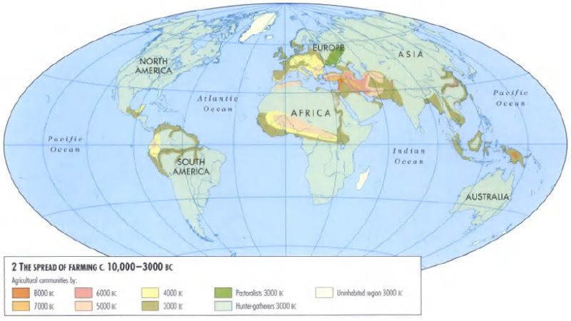
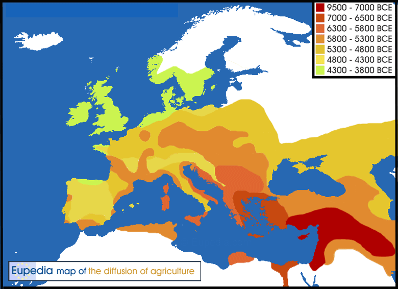
I have created a new map showing the spread of agriculture from its origins in the Near East around 9500 BCE until the adoption of farming in the British Isles and Scandinavia around 4000 BCE.
The Baltic, northern Russia and Finland are in white because farming only reached that part of the continent around 2500-2000 BCE, when bronze-age Indo-Europeans migrated northward. I do not have the dates for northern Anatolia.
Keep in mind that the ocean/sea levels were lower than now in the early Neolithic. Britain was still attached to mainland Europe when agriculture spread from Anatolia to Greece around 7000 BCE. It only became an island around 6500 BCE. The Aegean was lower too, which undeniably facilitated the crossing from Asia to Europe. Some of the earliest agricultural sites in the Aegean may well be under water now.
Last edited:
")