
I have updated the two Neolithic maps of Europe. In the first map (5000-4000 BCE) I have adjusted the sea levels (-10/15m) to what it really was at the time. We can see for instance that Denmark was connected to Sweden, Sardinia to Corsica. The north of the Black Sea was considerably smaller and the Sea of Azov didn't exist yet. The Dardanelles Strait also didn't exist and the Sea of Marmara was an inland sea.
I have also added major megalithic sites (standing stones, as opposed to the Late Neolithic dolmens and passage graves) and shown the progression (dots) of the Cardium Pottery Culture into hunter-gatherer territory (Tardenoisian).
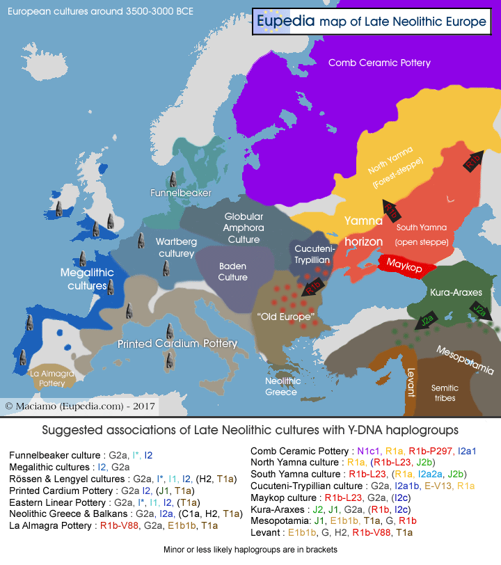
The Late Neolithic map also has slightly lower sea levels (-2m), which affects mostly Denmark and the Black Sea.
Actually, it is possible that the Sea of Azov didn't exist at all until the land bridge connecting Crimea to the North Caucasus was submerged by the rising Black Sea. This could have happened sometime between 4500 and 3500 BCE. This loss of land displaced a lot of people, and I believe that it could have had something to do with the first migration of steppe nomads (presumably R1b1b2a PIE speakers) into the Carpathians and the Balkans.
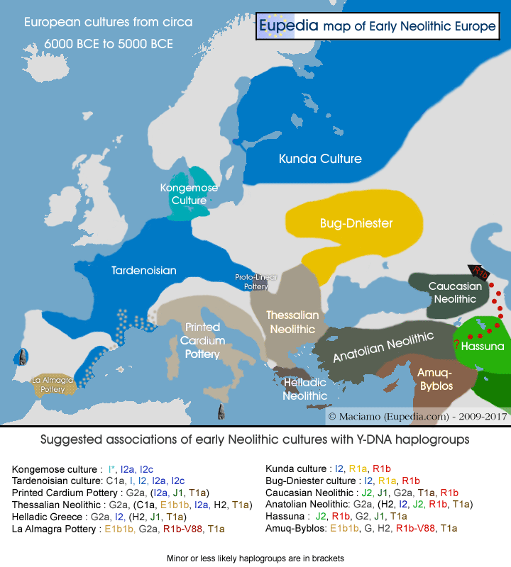
I have also added major megalithic sites (standing stones, as opposed to the Late Neolithic dolmens and passage graves) and shown the progression (dots) of the Cardium Pottery Culture into hunter-gatherer territory (Tardenoisian).
The Late Neolithic map also has slightly lower sea levels (-2m), which affects mostly Denmark and the Black Sea.
Actually, it is possible that the Sea of Azov didn't exist at all until the land bridge connecting Crimea to the North Caucasus was submerged by the rising Black Sea. This could have happened sometime between 4500 and 3500 BCE. This loss of land displaced a lot of people, and I believe that it could have had something to do with the first migration of steppe nomads (presumably R1b1b2a PIE speakers) into the Carpathians and the Balkans.
Last edited: