I've already said I don't think this is precisely what Reich had in mind, and I'm not necessarily a proponent of it, much less did I create it, so no need to be "sorry", but I must say I don't understand the issue with the things you cite.
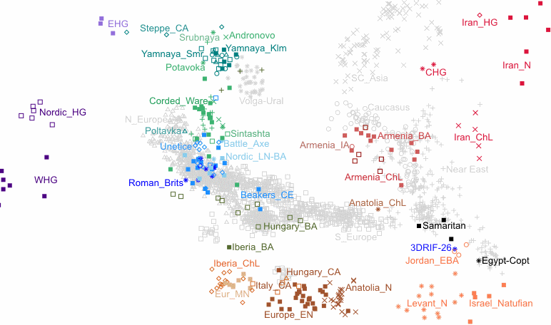
Why would an ancient population like ANE be on this map? They're talking about a period around, at the earliest, maybe 10,000 years ago. Do you know how old the ANE sample is? Clearly, it's also not a map aiming to show every possible place where you could find EHG. SHG isn't there either. It's not about that.
Nor do I know what you mean about Natufians being "all packed together" with no distinction terms of ylineage. Again, this isn't a map about the yDna of the farmers. All it's trying to show is the spread of farmers from the Levant Neolithic north into both western and eastern Anatolia. There's absolutely nothing misleading about it.
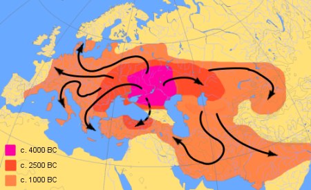
Where have you ever seen a map of the spread of the Indo-European languages which shows the kind of detail you're talking about?
What they should have included, imo, is a line showing the spread of farmers into India, as I mentioned above.
I also believe, although I'm perfectly willing to change my mind if there is evidence to the contrary, that a steppe population, or steppe admixed population entered India bearing R1a and the Indo-European Indian languages, and if I'm understanding the Krause schematic, I don't see that depicted there.