On the other hand, the analysis of reconstructed PIE terms for topographical features and related attributes and beliefs suggests that at some stage of their history, the Indo-Hittites lived in a mountainous terrain, where the mountain was a “mighty cliff reaching to the sky”, and there were precipices,swift rivers and a sea or large lake nearby (Gamkrelidze, Ivanov 1995: 574–577; Dybo 2013), excluding the steppe as a possible homeland (see 2.2).
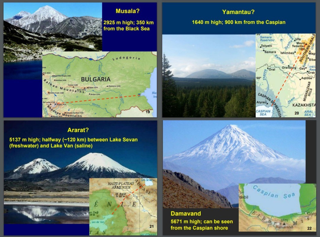
Provided that all these geographic features must be found in broadly the same area, this leaves us, in essence, with two possibilities. We must discard the southern Urals, where the most salient mountain, Yamantau, 1640 m high, is situated 900 km north of the Caspian Sea. One of the remaining options is the area with three large lakes, Sevan, Van, and Urmia, two of which are saline and thus similar to seas, and Mount Ararat, 5137 m high, towering 120 km southwest of Lake Sevan (freshwater) and at about the same distance northeast of Lake Van (saline). But an even better option is northern Iran, where the majestic dome of Damavand, 5610 m high — the second highest dormant volcano in Asia — can be viewed directly from the Caspian shore,30 and tumultuous rivers, most notably Safidrud, break through the Elburz range. It appears likely, then, that the Indo-Hittites migrated to the southern Caucasus and further west along the Elburz and Zagros ranges by the route that, several millennia later, was known as the Great Khorasan Road (Majidzaeh 1982; Ivanova 2012; 2013: 121–129).