New map of the Bell Beaker phenomenon

Maciamo

Veteran member
Admin
Messages
10,175
Reaction score
3,598
Points
113
Location
Lothier
Ethnic group
Italo-celto-germanic
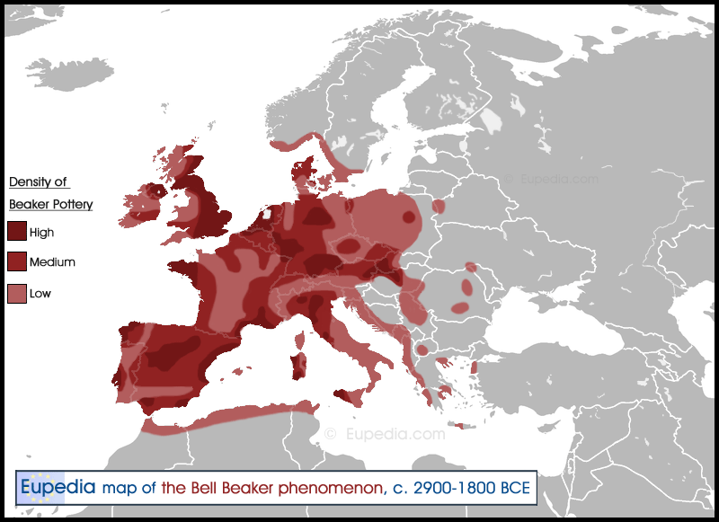
I finally got around to create a map about the Bell Beaker phenomenon. It was a complex task as there are already many maps out there, but few agree on the distribution of the Beaker and the main hubs of this vast commercial network. Some maps show arrows of the probable diffusion of the beakers - although usually in a confused and highly hypothetical way. Others display the various regional subgroups. Yet, none seem to agree with one another. So I decided to adopt a new approach and show the density of beaker pottery. The high density areas are presumably the main trade hubs. As usual, to facilitate the visualisation I have added the borders of modern countries. I have also made a page about the genetics of the Bell Beakers.
Bell_Beaker.png
 
Interesting, Thanks. But I suppose it covers the allover BB's period, so without distinction between subperiods? The BB's story is a so complicated phenomenon, what explains the striking opposition of some views.
 
Yes, the map shows all the Beaker pottery sites regardless of the chronology. It would not have been possible to show the progressive diffusion in a single map, and anyway there is no reliable data to do that.
 
@Maciamo
Thanks for this interesting thread.
Perhaps can be relevant this article: "Around Maritime beaker: the vases à cordon, linear beakers and épicampaniforme productions in north-western France". Author: QUENTIN FAVREL, Préhistoires Méditerranéennes, 8, 2020.


There is a Chronological and spatial scope of the Bell Beaker phenomenon in north- western France.
 
I finally got around to create a map about the Bell Beaker phenomenon. It was a complex task as there are already many maps out there, but few agree on the distribution of the Beaker and the main hubs of this vast commercial network. Some maps show arrows of the probable diffusion of the beakers - although usually in a confused and highly hypothetical way. Others display the various regional subgroups. Yet, none seem to agree with one another. So I decided to adopt a new approach and show the density of beaker pottery. The high density areas are presumably the main trade hubs. As usual, to facilitate the visualisation I have added the borders of modern countries. I have also made a page about the genetics of the Bell Beakers.

Bell_Beaker.png

interesting
high density areas may have been trading centres indeed
I wonder though about the high density area in central Iberia
wasn't this area one of the earliest Bell Beaker areas?
 
Hello Maciamo, I am curious as to where I can find the most accurate percentages for the Y-DNAs of Sicily and Malta. I saw a forum on Anthrogenica, where someone posted data from family tree DNA, which showed J2 and E1b1b to be much higher in frequency than R1b. But the page here and the one on Wikipedia, shows that Sicilians and Maltese have higher frequencies of R1b over both J (J1+ J2) and all E subclades.
 
interesting
high density areas may have been trading centres indeed
I wonder though about the high density area in central Iberia
wasn't this area one of the earliest Bell Beaker areas?
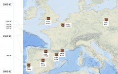
An idea of the earliest BB areas can be formed with the plot of some ancient individuals associated to BB (ID and y-haplogroup) across Europe:

BBmap3.jpg
 
Back
Top